
UAV Command and
Control Terminal System
Integrated UAV control terminal systems for unmanned platforms — from portable handheld units to ruggedized vehicle-mounted stations. Designed for operators who need reliable human-machine interface across single-vehicle and multi-asset missions. Compatible with fixed-wing platforms, multi-rotor platforms, and specialized unmanned systems.
Unified Terminal Hardware for
Every Mission Profile
The SoarApex UAV Control Terminal System – CCT Series combines flight control, payload management, and mission intelligence into unified terminal hardware. Each system is configurable for your platform protocol, environmental conditions, and operational workflow. Seamlessly couples with our wireless data link system and antenna tracking system for complete command architecture.
Flight Control & Telemetry
Real-time 3D attitude, waypoint nav
Payload Command & Management
Multispectral, thermal, LiDAR control
Mission Planning & Execution
Grid patterns, search algorithms
Multi-Platform Compatibility
ArduPilot, PX4, INAV, Betaflight
Field-Deployable Ruggedization
IP67, MIL-STD-810G, -20°C to +60°C
Standalone or Integrated
Available as standalone units or seamlessly integrated into broader command architectures. Already have a data link or antenna tracker? Our engineering team ensures seamless integration with your existing SoarApex wireless data link system or antenna tracking system, as well as third-party hardware.
Protocol Agnostic Architecture
Native MAVLink and CRSF support with adaptable layers for proprietary protocols. Compatible with ArduPilot, PX4, INAV, Betaflight, and custom autopilot stacks. Integrate our terminal into your existing fixed-wing or multi-rotor fleet.
Mission-Centric HMI Design
Interface layouts tailored to operational roles — agricultural spraying, survey grid execution, search pattern management, or tactical coordination. Customizable button mappings and alert thresholds matched to operator workflow and environmental conditions.
Global Deployment Ready
IP67-rated enclosures, -20°C to +60°C operating range, MIL-STD-810G shock resistance. Sunlight-readable displays and glove-compatible touchscreens for uninterrupted operations. Pair with our power station system for extended field endurance.
Command & Control Terminals
From single-UAV handheld controllers to multi-vehicle C2 center integration — unified terminal hardware built on open protocol architecture. Seamlessly couples with our wireless data link system and antenna tracking system for complete mission readiness.
Complete CCT Ecosystem
Five operational tiers — each configurable for protocol, environment, and mission type. Every UAV control terminal shares the same open architecture, ensuring seamless interoperability across your entire fleet, from multi-rotor platforms to fixed-wing platforms and specialized unmanned systems.
Handheld Controllers
Single UAV, FPV, and precision agriculture operations. Ultra-portable with daylight-readable displays, extended battery life, and glove-compatible interfaces. Compatible with all major multi-rotor and fixed-wing flight stacks.
- Integrated HD display with adjustable sunshade
- Dual-stick Hall-effect precision control
- 4+ hour battery endurance with hot-swap support
- Native MAVLink / CRSF with protocol adaptation layer
Portable Integrated Stations
Industrial multi-mission UAV ground control station for field operations. All-in-one command center in a rugged transport case with sub-minute deployment. Pairs with SDL data links for extended range missions.
- Large-format sunlight-readable display (1000+ nits)
- Triple-frequency redundancy (2.4G / 5.8G / 4G LTE)
- Integrated joystick, keyboard, and mission planning suite
- Seamless SDL data link coupling
Ruggedized Laptop & Box Terminals
Survey, mapping, and extended deployment in harsh environments. MIL-STD-810G compliant with IP67 protection and multi-screen support. Powered by portable power station systems for off-grid operations.
- -20°C to +60°C full operating range
- MIL-STD-810G shock and vibration resistance
- Hot-swappable battery system for continuous ops
- Multi-screen / multi-vehicle fleet management
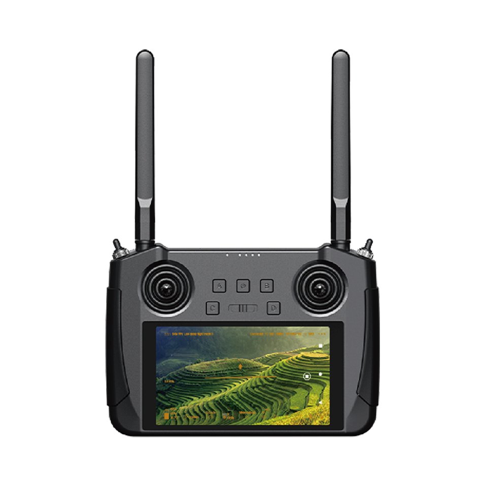
MK15A Agriculture UAV Ground Station
Compact handheld terminal optimized for precision agriculture with variable-rate payload control and multispectral camera management.
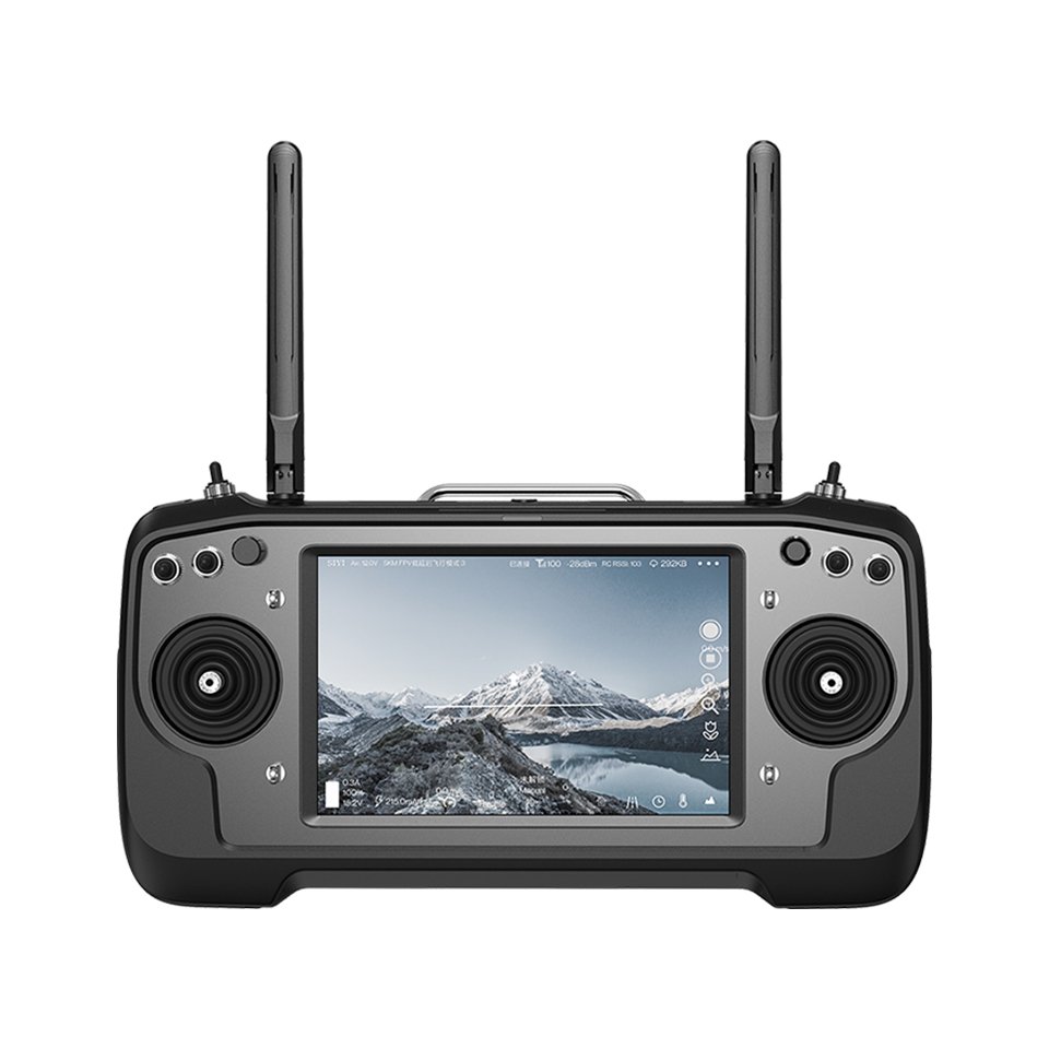
MK32E Professional fpv & UAV Control Terminal
Enhanced handheld controller with 7″ display, HDMI output, and dual-band radio for professional FPV and commercial UAV operations.
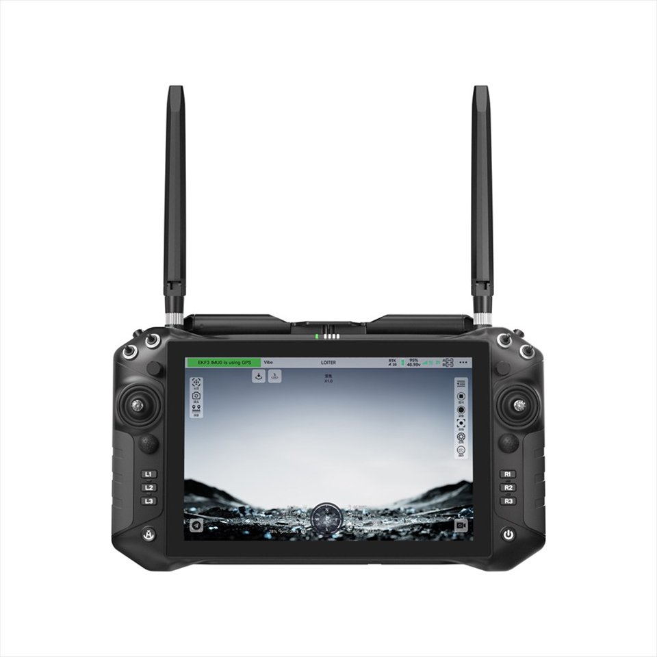
UniRC10 Pro Ground Control Station
Flagship 10″ handheld terminal with RTK positioning, 4G LTE connectivity, and advanced mission planning for commercial-grade operations.
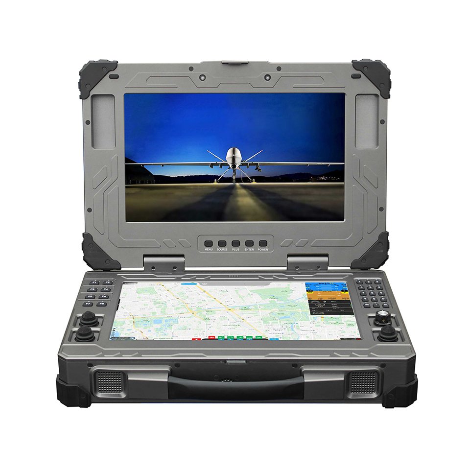
S02 Industrial UAV/USV Control Station
All-in-one portable command center with 15.6″ sunlight-readable display, integrated controls, and rugged transport case for field deployment.
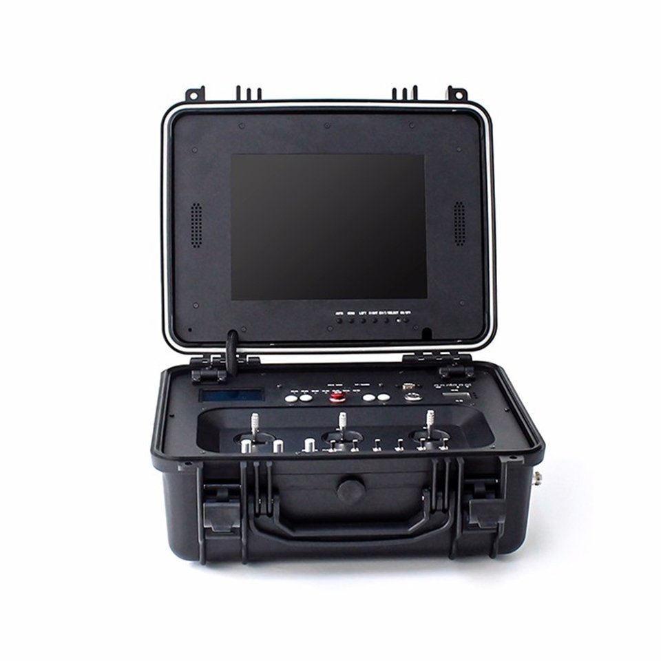
LKAV 1422 Dual-Screen Field Station
Dual-display portable GCS with dedicated mission planning screen and FPV feed, housed in a MIL-STD rugged transport case.
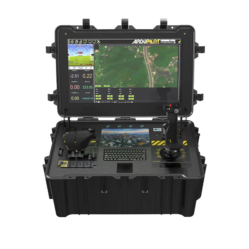
S01 Multi-functional VTOL Control Station
MIL-STD-810G ruggedized box terminal with integrated joysticks, flight controller, and multi-screen support for survey and extended deployment.
Integrated C2 System for
UAV Capabilities
Command, control, and communicate — a unified architecture that reduces operator cognitive load while maximizing mission effectiveness across every operational domain, from multi-rotor platforms to fixed-wing platforms and specialized unmanned systems.
Unified Flight & Payload Control
Single-interface command of flight parameters, waypoint navigation, and payload operations across multi-rotor and fixed-wing platforms. Real-time telemetry fusion with 3D attitude display, voice broadcast alerts, and emergency abort protocols — reducing operator cognitive load during complex UAV missions.
Open Protocol Architecture
Native MAVLink and CRSF support with adaptable layers for proprietary protocols. Compatible with ArduPilot, PX4, INAV, Betaflight, and custom autopilot stacks. Integrate our UAV control terminal into your existing fleet or adapt our firmware to your communication standard.
Mission-Centric HMI Design
Human-machine interface layouts tailored to operational roles — agricultural spraying, survey grid execution, search pattern management, or tactical coordination. Customizable button mappings, data dashboards, and alert thresholds matched to operator workflow and environmental conditions.
Ruggedized for Field Continuity
IP67-rated enclosures, -20°C to +60°C operating range, MIL-STD-810G shock and vibration resistance. Sunlight-readable displays, glove-compatible touchscreens, and hot-swappable power station systems for uninterrupted operations in demanding environments.
Platform Ecosystem & Connectivity
The UAV Control Terminal System functions as a command node within your unmanned platform ecosystem — not an isolated controller.
UAV Control Terminal System Architecture
Human-Machine Interface
Multi-screen, touch/glove-compatible, AR-ready displays with adaptive brightness for all lighting conditions.
Data Link Coupling
Direct integration with SoarApex SDL Series for long-range, high-bandwidth communication links.
Application Layer
Flight planning, payload control, mission analytics with real-time data visualization and reporting.
Payload Integration
Multispectral, thermal, LiDAR, delivery systems with unified command interface and status monitoring.
Communication Layer
MAVLink/CRSF, WiFi/Bluetooth/4G, SDL integration with automatic failover and redundancy protocols.
Network Connectivity
Mission data sync, remote diagnostics, cloud-backed telemetry storage with end-to-end encryption.
Hardware Platform
Handheld/laptop/vehicle-mounted form factors with hot-swappable batteries and modular expansion.
Certification Support
FCC, CE, MIL-STD compliance pathways with full documentation and testing support for global deployment.
Application Support
Purpose-built UAV control system configurations for every operational domain — from precision agriculture to emergency response.
Precision Agriculture Command
Handheld UAV control terminal for precision agriculture crop spraying coordination on multi-rotor platforms, variable-rate payload control, and multispectral camera management — daylight-readable for dawn-to-dusk operations.
Geospatial Survey Operations
High-brightness laptop and box terminals for photogrammetry mission planning with fixed-wing platforms, LiDAR payload monitoring, and real-time 3D data validation in the field.
Emergency Response Coordination
Rapid-deploy portable stations for disaster scene assessment, search pattern management, and multi-team coordination with specialized unmanned systems under BVLOS time-critical conditions.
Powerline & Infrastructure Inspection
Vehicle-mounted and portable terminals for BVLOS transmission line patrol with antenna tracking system support, thermal payload control, and defect annotation with automated reporting.
Frequently Asked Questions — System Integration & Deployment
Configure Your Command & Control Terminals
Select from standard configurations or discuss custom specifications for your platform, protocol, and operational environment. Our engineering team provides integration guidance from terminal selection to field deployment.