
Mission-Critical UAV Data Link Solutions for Industrial Operations
Across air, sea, and land domains, SoarApex delivers integrated communication infrastructure that enables BVLOS autonomy, swarm coordination, and real-time situational awareness. Our antenna tracking system and C2 system work seamlessly with Fixed-wing Platforms and Multi-rotor Platforms.
Long Range Wireless Data Link System Products
From system design to deployment, our wireless data link system integration services span air, sea, and land domains. Compatible with Fixed-wing Platforms, Multi-rotor Platforms, and Specialized Unmanned Systems.
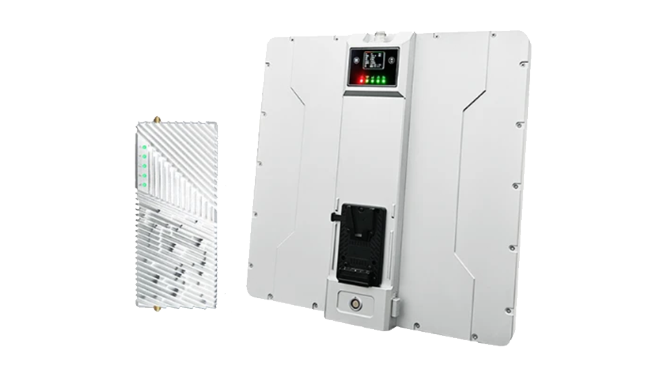
SDL-MK150 High-Gain Ground Station
Directional high-gain antenna array with automatic tracking for BVLOS operations up to 150km.
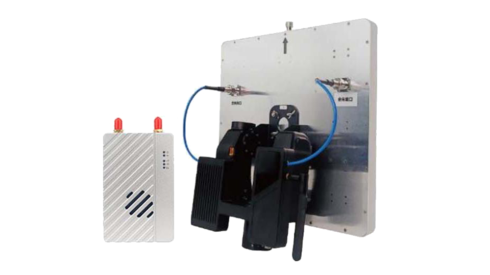
SDL-MK80 Portable Tripod System
Rapid-deploy tripod-mounted antenna with integrated RF module for field operations.

SDL-Airborne UAV Data Link
Compact airborne transceiver with dual-band capability for UAV/USV/UGV platforms.
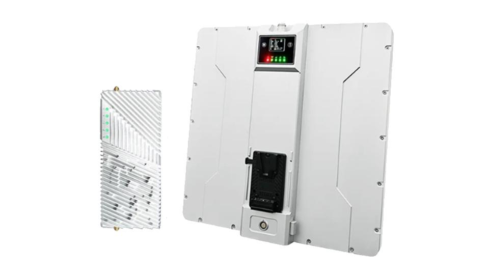
SDL-MK200 19" Rack System
Enterprise-grade rack-mount data link hub for command center integration with multi-link management.
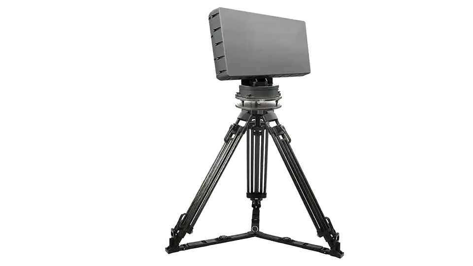
SDL-Relay Mesh Network Node
Self-healing mesh relay node for extending coverage beyond line-of-sight in complex terrain.
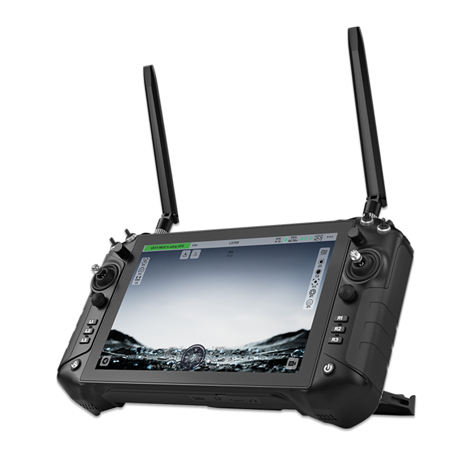
SDL-Handheld Tactical Controller
Ruggedized handheld GCS with integrated data link, 7" sunlight-readable display, and dual joystick.
Why SoarApex as Your Integration Partner?
Decades of expertise in unmanned systems integration, delivering mission-critical communication solutions worldwide.
Deep Domain Expertise
10+ years in RF communication and unmanned systems integration. Our engineering team holds advanced degrees in telecommunications, signal processing, and aerospace engineering — with hands-on experience in UAV antenna tracking system across defense, energy, and public safety sectors. Our C2 system solutions power mission-critical operations worldwide.
Learn MorePlatform-Agnostic Integration
We integrate with your existing infrastructure — whether fixed-wing, multirotor, VTOL, ground vehicles, or maritime platforms. Support for MAVLink, ROS, STANAG 4586, and custom protocols. No vendor lock-in.
View ProtocolsRegulatory & Certification Navigation
Global regulatory compliance support including FCC, CE, MIC, and military certification pathways. We guide you through frequency allocation, type certification, and operational authorization for BVLOS missions worldwide.
Certification GuideFlexible Partnership Models
From off-the-shelf module supply and technical consulting to full turnkey system delivery. Power your fleet with our power station system for extended operations. We adapt to your procurement process — whether you need standard components, custom development, or a long-term strategic partnership with dedicated engineering support.
Partnership OptionsUAV Data Link - System Capabilities
Comprehensive communication infrastructure covering command uplink, situational awareness downlink, and networked multi-asset operations.
Command & Control (Uplink)
Mission-critical command delivery with guaranteed low-latency transmission for takeoff, landing, waypoint navigation, payload control, and emergency abort operations. Integrated with our C2 system and antenna tracking system for seamless BVLOS command chains.
- Takeoff & landing sequence control
- Waypoint navigation & path planning
- Payload control & gimbal steering
- Emergency abort & RTL commands
- Contested electromagnetic environments
Situational Awareness (Downlink)
Real-time ISR data fusion streaming position, altitude, velocity, battery status, attitude, HD video, thermal imaging, LiDAR, and multi-spectral data to ground stations. Compatible with Fixed-wing Platforms and Multi-rotor Platforms.
- Position, altitude & velocity telemetry
- HD video & thermal imaging stream
- LiDAR point cloud transmission
- Multi-spectral sensor data fusion
- Sub-frame latency for C2 centers
Networked Operations
Multi-asset coordination enabling swarm orchestration, cluster strikes, manned-unmanned teaming (MUM-T), and cross-domain interoperability across air-sea-land domains. Supports Specialized Unmanned Systems including USV and UGV integration.
- Swarm orchestration & formation control
- Manned-unmanned teaming (MUM-T)
- Cross-domain interoperability
- Dynamic task allocation & re-routing
- Mesh network self-healing topology
UAV Data Link - Industry Solutions
Tailored BVLOS UAV data link solutions across critical industries — from power infrastructure to national defense.
Power & Utilities
Integrated UAV data link system for BVLOS inspection of transmission lines, wind farms, and solar installations — reducing inspection costs by 60% and eliminating tower climbing risks. Paired with our power station system for extended field operations.
Key capabilities for power sector:
- 150km+ BVLOS corridor coverage
- Thermal anomaly detection integration
- LiDAR point cloud real-time validation
- Automated defect reporting pipeline
Public Safety & Emergency Response
Rapid-deploy communication networks for disaster zones. Our mobile C2 system ground stations establish 30km+ links within 15 minutes of arrival, providing immediate situational awareness. Compatible with Multi-rotor Platforms for urban search and rescue.
Key capabilities for public safety:
- 15-minute rapid deployment
- 30km+ range in urban canyons
- Mesh relay for building penetration
- Multi-agency interoperability
Geospatial & Surveying
End-to-end photogrammetry and LiDAR integration with real-time data link validation, enabling same-day 3D model delivery and quality assurance during flight. Optimized for Fixed-wing Platforms with long-endurance mapping missions.
Key capabilities for surveying:
- Real-time RTK/PPK data validation
- 30Mbps photogrammetry stream
- Same-day 3D model pipeline
- Multi-spectral sensor fusion
Border Security & Critical Infrastructure
Persistent surveillance networks with automatic handoff between relay nodes — 24/7 operations across 100km+ corridors with zero downtime handover. Our antenna tracking system ensures continuous connectivity for Specialized Unmanned Systems.
Key capabilities for security:
- 100km+ persistent corridor
- Automatic relay handoff
- 24/7 autonomous patrol scheduling
- AI-powered anomaly detection
Defense & National Security
MIL-STD compliant communication systems for ISR, target designation, and electronic warfare — field-proven in contested electromagnetic environments with FHSS anti-jamming capabilities. Integrated with ruggedized C2 system terminals.
Key capabilities for defense:
- MIL-STD-810G / 461 compliance
- FHSS anti-jamming waveform
- AES-256 + custom encryption
- Contested environment proven
Precision Agriculture
Fleet management systems for autonomous crop monitoring and variable-rate application — from single UAV to 50+ drone operations with centralized mission control. Powered by power station system for all-day field coverage on Multi-rotor Platforms.
Key capabilities for agriculture:
- 50+ drone fleet coordination
- Variable-rate prescription maps
- Multi-spectral crop health index
- Automated spray mission planning
Frequently Asked Questions
System Integration & Deployment
Custom: 8–16 weeks including design, validation, testing & training. Expedited available.
LOS: Direct visual contact, 5–10km range.
BVLOS: Beyond visual range, 150km+ with antenna tracking and relay nodes. Essential for inspection, delivery & surveillance.
S-band (2.4GHz): Balanced range/data
C-band (5.8GHz): High data rate
Custom: Defense & specialized applications
Ready to Start Your System Integration Project?
Every mission is unique. Our engineers begin with understanding your operational requirements, then design and deliver an integrated communication solution tailored to your platform and mission profile. From antenna tracking systems to C2 terminals and power solutions — we cover the full unmanned ecosystem.