
As commercial UAV operations push beyond visual line of sight (BVLOS), the industry has realized a hard truth: individual components do not make a mission reliable—integrated UAV BVLOS mission system does. At SoarApex, we engineer end-to-end BVLOS architectures where automatic antenna tracking, long-range data links, and ground control stations (GCS) operate as a single, adaptive platform.
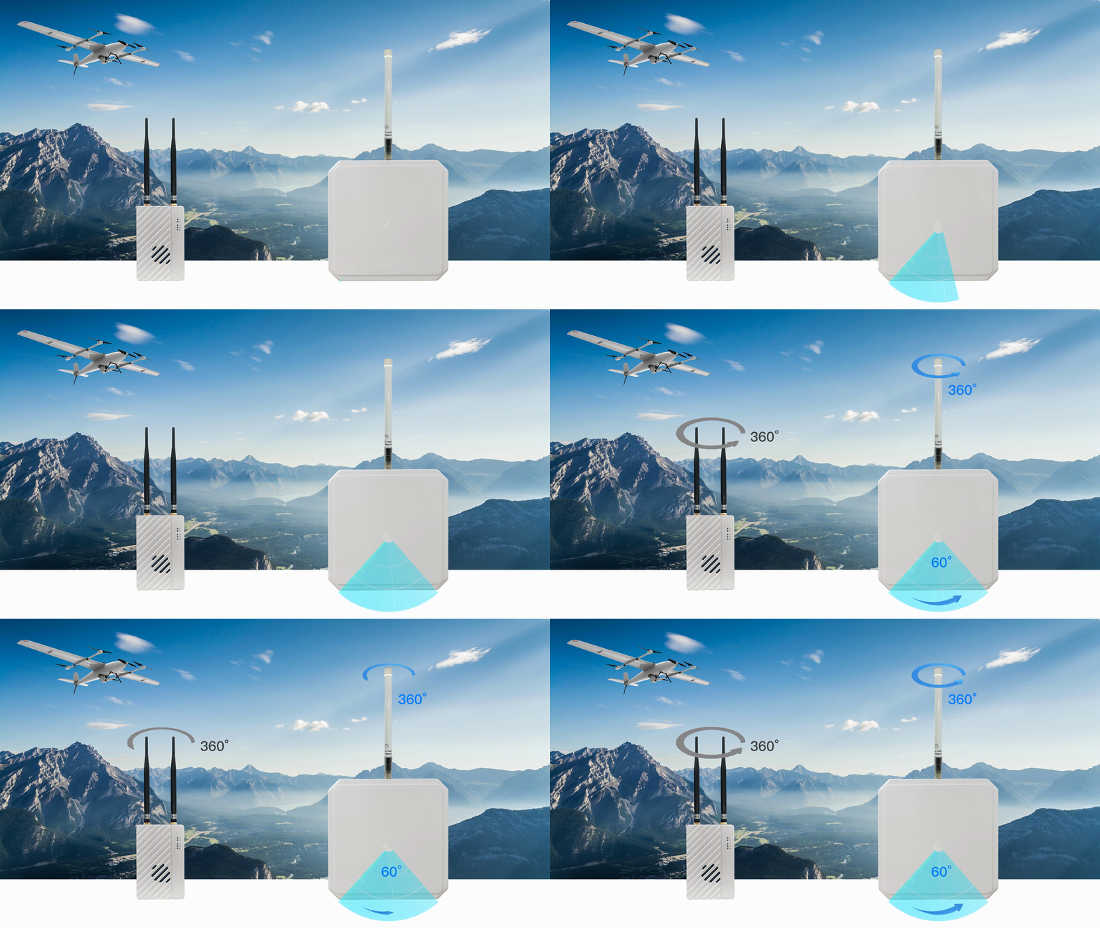
Figure 1: End-to-end BVLOS mission architecture requires seamless coordination between air and ground systems.
The Integrated UAV BVLOS Mission System Imperative: Why Is the Only Path Forward
Operating drones beyond 50 km introduces compounding technical risks: signal degradation, latency spikes, handoff failures between ground stations, and fragmented situational awareness. Addressing these in isolation leads to brittle, patchwork systems.
True operational reliability comes from an end-to-end integrated architecture where antenna trackers, radio links, and GCS software share telemetry streams, predict link margins, and adapt in real time. This is the core philosophy behind every SoarApex deployment.
Regulators worldwide are also pushing the industry toward higher safety standards for BVLOS. The FAA’s Advanced Operations framework↗ and the EASA civil drones regulations↗ both emphasize system-level risk mitigation over component-level waivers.
The Three Pillars of SoarApex Integrated Architecture
1. Automatic Antenna Tracking System
Our integrated UAV BVLOS mission system – automatic antenna tracking for BVLOS drones solutions eliminate manual pointing bottlenecks and maximize link budget throughout the mission envelope:
- 45 km+ tracking range with high-gain directional arrays
- Real-time UAV position fusion via MAVLink telemetry and onboard GPS
- Dual-axis precision servo control with predictive pointing algorithms
- Native integration with SoarApex data link radios for closed-loop optimization
By maintaining optimal antenna alignment, the tracking system ensures the data link operates at maximum effective range with minimal packet loss—even during aggressive UAV maneuvers or terrain-masked flight paths.
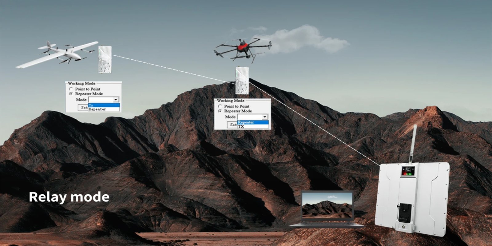
Figure 2: High-gain directional antenna arrays are the critical bridge between the UAV and the ground station.
2. Long-Range Data Link & Video Transmission
The integrated UAV BVLOS mission system – data link is the lifeline of any BVLOS operation. Our integrated long range UAV data link ground station systems provide:
- 100 km+ wireless data link transmission for HD video and MAVLink telemetry
- Triple-frequency redundancy (via UniRC 10 Pro) for interference resilience
- Adaptive modulation and bandwidth management based on real-time link quality feedback
- Encrypted IP-based streaming compatible with standard GCS protocols
Crucially, the data link is designed to interface natively with our antenna trackers—link quality metrics (RSSI, SNR, packet loss) are shared in real time to optimize tracking behavior and preemptively trigger handoff logic.
These systems align with international radio standards established by the ITU-R↗, ensuring spectral compliance across global deployment regions.
3. Ground Control Station (GCS) Ecosystem
A powerful integrated UAV BVLOS mission system – GCS ties the mission together. Our ground station portfolio includes:
- UniGCS v3.0 — enhanced flight controller tuning, mission planning, and real-time telemetry visualization
- UniRC 7 Pro / UniRC 10 Pro — professional handheld and triple-frequency ground stations
- Multi-UAV fleet management and seamless station-to-station handoff coordination
- Integrated payload control for inspection, patrol, and surveying missions
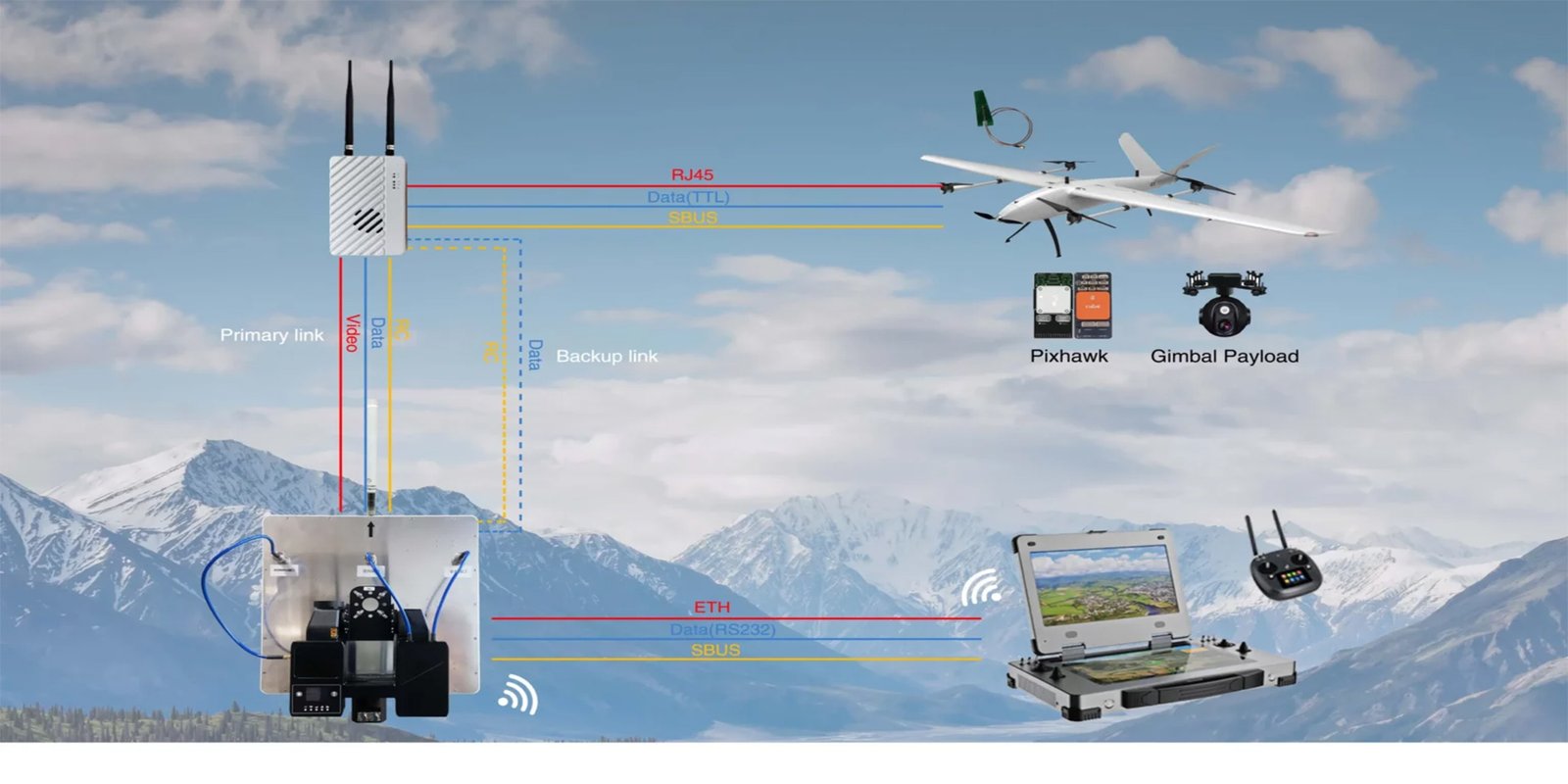
Figure 3: The GCS serves as the mission’s central nervous system, integrating video, telemetry, and control.
How the Integrated Stack Performs in Real-World Missions
Consider a typical powerline inspection mission spanning 80 km of remote terrain:
- Pre-flight: UniGCS v3.0 uploads the waypoint mission and calculates predicted RF link margins along the route using terrain-aware path planning.
- Takeoff & Transit: The automatic antenna tracker locks onto the UAV immediately, maintaining alignment as the aircraft climbs and transits to the inspection corridor.
- BVLOS Operations: The long-range data link delivers continuous 1080p video and telemetry. If link quality drops, the tracker adjusts gain and pointing, while the GCS alerts the operator and logs the event.
- Payload & Inspection: The operator commands the gimbal payload through the GCS, captures high-resolution imagery, and geotags anomalies—all over the same integrated data pipe.
- Return & Landing: Handoff logic ensures zero dropouts during the return leg, with the tracker smoothly following the descent profile until touchdown.
Key Insight: System-Level vs. Component-Level Thinking
This is not a collection of separate products. It is a single, integrated mission system where each subsystem is aware of the others. When the data link detects fading, the antenna tracker pre-positions; when the GCS predicts a terrain mask, it alerts the operator before the link degrades. That is the SoarApex difference.
Technical Specifications at a Glance
| Subsystem | Capability | Integration Benefit |
|---|---|---|
| Antenna Tracking | 45 km+ range, dual-axis servo, GPS/telemetry fusion | Maximizes link budget; shares position data with GCS |
| Data Link | 100 km+ IP video/telemetry, triple-frequency, AES encryption | Feeds real-time link metrics to tracker and GCS |
| GCS Software | UniGCS v3.0, multi-UAV, mission planning, payload control | Central command layer; orchestrates tracker and radio handoffs |
| Ground Hardware | UniRC 7 Pro / 10 Pro handheld & rack-mount stations | Common hardware platform reduces training and logistics cost |
Conclusion & Next Steps
BVLOS operations demand more than individual high-performance components—they demand system-level integration. SoarApex`s integrated UAV BVLOS mission system delivers fully integrated UAV mission system where antenna tracking, data links, and ground control stations operate as a single, coherent platform.
Whether your mission is infrastructure inspection, environmental monitoring, wildlife patrol, or tactical surveillance, our integrated architecture ensures you maintain command, control, and situational awareness—no matter how far your drone flies.
Ready to Integrate Your BVLOS Operations?
Contact the SoarApex engineering team to discuss your mission profile, link budget requirements, and system configuration.
Contact SoarApex →SoarApex — Integrated UAV BVLOS Mission System for Beyond Visual Line of Sight Operations.